The Strategy
Operational roadmap and data-driven planning
Pamplona faces the challenge of evolving towards a sustainable, resilient urban model prepared for the climatic and inclusive challenges of the 21st century. To achieve this, it is necessary to adopt advanced tools capable of unifying territory, mobility, public space, biodiversity, and citizen well-being. This pilot project provides the municipal administration with a data-driven operational environment, where early generative urban design, environmental simulations, and real-time proximity methodologies are connected on the integrated POWERBIM platform. The strategic scope is structured into five central axes:
- GENERATIVE URBAN DESIGN WITH AUTODESK FORMA
- CLIMATE AND URBAN HEAT ISLAND SIMULATION
- MULTI-SCALE INTEGRATION OF ENVIRONMENTAL DATA
- DYNAMIC 15-MINUTE CITY ACCESSIBILITY ANALYSIS
- COMPARATIVE ANALYTICAL KPI DASHBOARDS FOR
GOVERNANCE
This digital solution unifies parametric modeling with proximity analysis and climate simulation, allowing for anticipatory urban governance based on verifiable metrics under the POWERBIM ecosystem.
Developed Technologies
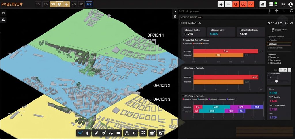
Automatic generation and evaluation of multiple parametric urban design alternatives in initial phases. It allows for the instantaneous calculation of buildability, density, floor area, and land use distribution KPIs, accelerating decision-making by municipal technical departments.
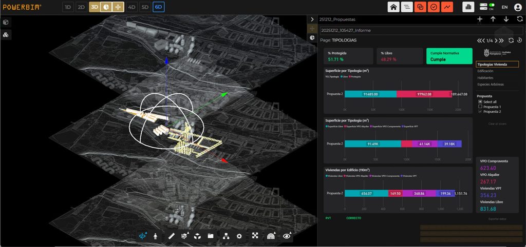
Automatic loading of urban scenarios as structured digital models in POWERBIM. A single dashboard unifies and dynamically contrasts key project indicators
: housing typologies (public, protected, free market), estimated population, building density, and carbon footprint estimates.
Multi-scale technical fusion of detailed BIM models with Geographic Information Systems (GIS). Through the use of open standards (OpenBIM), full interoperability is ensured
with the administration’s databases and any stakeholder involved in the infrastructure lifecycle.
Advanced environmental simulations that analyze the impact of design on the local microclimate and the heat island effect. It allows for the prediction and optimization of shading conditions, surface materials, and tree cover to maximize thermal comfort and reduce the climatic vulnerability of public spaces.
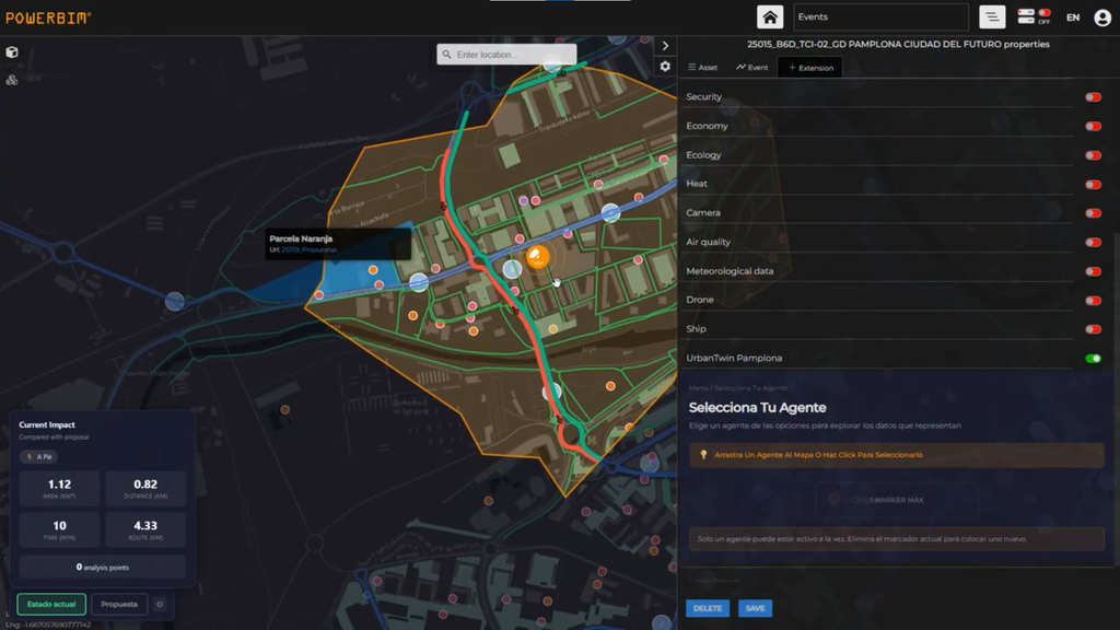
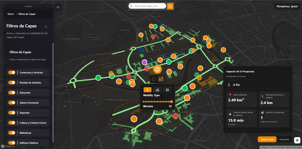
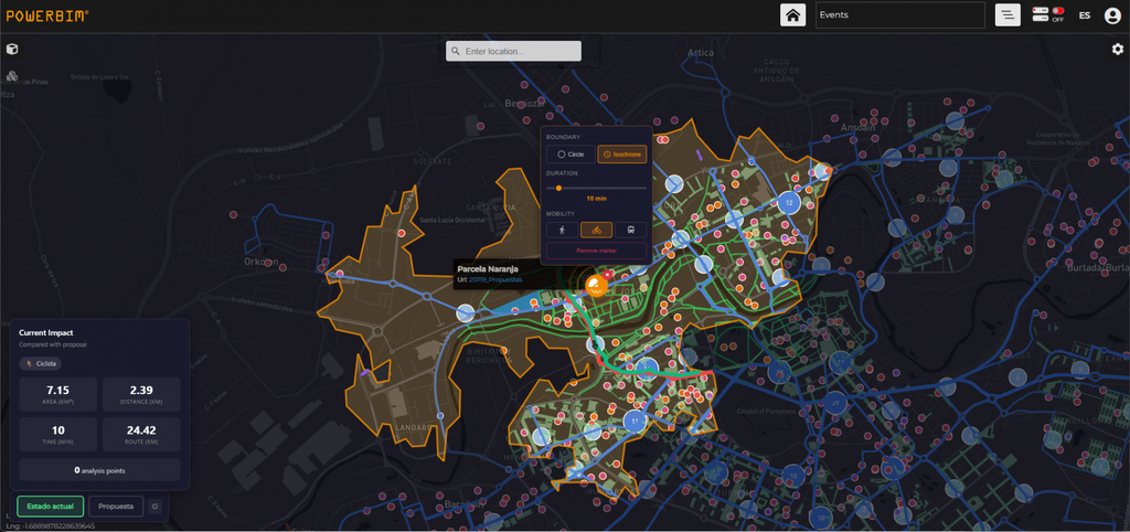
Implementation of an advanced GIS module powered by AI agents that calculates isochrones and access to critical facilities (health, education, transport, leisure). Planners and institutions can evaluate the real area of influence and travel times by foot, bicycle, or public transport from any point.
Cooperative methodology validated in Pamplona that provides the public administration with operational tools for modern asset governance. It transforms urban plans from mere static descriptions into interactive and auditable digital twins.